Llyn Anafon - there and back (5.66 miles / 9.10km)
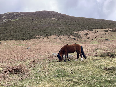
Todays walk was a strange one. With Anwen at nursery, it was myself, Megan and Naini who headed back into the Carneddau to complete a walk we had wanted to do for a while. We weren’t heading up any peaks this time, but along a valley towards the foot of Drum and to Llyn Anafon (Tlinn Anne av on). We had meant to go last week but I, in true teacher during the holidays form, had been ill… so we rearranged for today. This walk is a wee gem. Just up from the ridiculously popular, overcrowded, and rubbish strewn Aber Falls, we saw only two other groups… and one of them were in the wrong place and were looking for the falls! Although it’s uphill most of the way, it’s a steady incline and all on a rough but driveable track. You get the isolation of being in the mountains but the safety net of a very easy route to follow. The views are incredible and we saw plenty of animals - the Carneddau ponies of course, and birds like the Ring Ouzel and Wheatear. This is definitely a walk we will do again.
The second group we met on our walk was what put a particularly somber tone to the day. The second group we met was the Llanberis Mountain Rescue who set off at the same time as us and were also heading up to the lake. We followed their Land Rover up, catching up with them occasionally as they stopped to check the area. They were searching for a lady who had headed out 48 hours previously up into the hills with her dog and hadn’t returned home. She was an experienced mountain walker who had set out well prepared. During the 48 hours the Carneddau had experienced incredibly bad weather - snow, driving rain, hail and high winds. The rescue teams were on their second day of searches in the area and as well as the team we saw driving and on foot, the helicopter circled numerous times. Sadly, but maybe not surprisingly, we found out that evening after our walk that a woman’s body and a living dog had been found near Yr Aryg.
When you live near or in mountainous areas like we do, you get used to the many, many stories of the rescues, injuries and deaths that happen every year. You become almost desensitised to them. It was, therefore, very sobering to be surrounded by an ongoing search. Watching the team disappear up the mountainsides and to consider the vastness of their task made us feel very small, and very vulnerable. They really are incredible human beings, our search and rescue teams. Truly awe inspiring.
Distance: 5.66 miles / 9.10km (according to OS app.)
Time taken: 3hrs 30 (including a picnic)
Total ascent: 1528ft (OS app)
Parking: Yes. Free but limited.
Facilities: None.
Walkers: Me (35years, fat but I get there!), Megan (6yrs, full of energy and never stops talking), Naini (50s, fit and experienced mountain walker but struggles with back and hips)
I haven’t included numbers on todays walk because it really is a straightforward there and back. To park, head up towards Aber Falls, through the village of Abergwyngregyn (Abb err gwinn gregg in. Aber = mouth of the river. Gwyn Gregyn = white shells). After you cross the bridge over the river don’t turn right into the Falls car park but keep on straight up the single track to its end. It’s a steep, narrow and windy road with few passing places. There is a small, free car parking area at the top. There’s room for maybe 6 cars if parked sensibly.
Car park.
Once parked, head through the gate and onto the track which curves left. Up above you to the right you can see the track which we want to get to. There is a cut across past an old homestead but the start wasn’t that clear from the bottom and, even though it looked pretty straightforward, the last thing we wanted to do was add to the mountain rescue’s burden. As it happens we found the cut through on the way back (as you can see on the map) and it’s really straightforward and clear. We started though by heading up the rocky track towards the pylons, then turning right, back on ourselves, onto the higher track. It really didn’t add that much time or distance.
View from the car park.
Follow the track up and left from the car park.
Turn right to join onto the higher track.
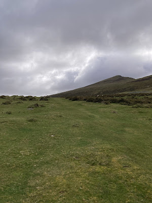
Once you’re on this higher track it’s pretty much this all the way. You follow the valley and go upriver all the way to the lake at the top. It’s hilly but not terribly steep at any point.
Follow the track!
Curving around Foel Dduarth (Voil Thee-arth: dd = th like in then.)
Moel (mutated to Foel) is a common name given to hills and mountains. It is the name often given to a rounded summit. It also means “bare”. Du is “black” and arth is probably a mutation of garth which is either an enclosure or a hill.
Looking over towards the forest at Aber.
Looking back at the car park beneath us. Ynys Môn and the Afon Menai can be seen in the distance.
The first of two sheepfolds next to the Afon Anafon.
Afon (Av-on) is the Welsh word for river. English place names with Avon in them actually take their names from the Celtic. The River Avon therefore is actually named river river!
Eryri Sheepfolds
Thousands of simple sheepfolds were built by hill farmers across Cymru, but in Eryri the practice was elevated into an art form. Here, there are at least 32 “multicellular” folds - ones containing four or more sections. The most elaborate folds, such as that at Y Gern near Llanllechid, have more than 20 separate compartments. Hundreds of others in Eryri are termed as “complex” sheepfolds, having 2 to 4 sections. Many of these incorporated shelters for shepherds and their animals. In total, 3511 sites in north west Cymru have been identified as possible sheepfolds, pens or small stone enclosures for sheep or goats. These are thought to be “only the tip of the iceberg”.
A few may date back to the mediaeval period, built from the remains of crumbled Welsh longhouses, but most were erected in the late 18th and 19th centuries. Many are still in use. In 2014, the social and economic importance of Eryri’s sheepfolds and related structures was assessed by Gwynedd Archaeological Trust for possible scheduling as sites of national importance. Report author Jane Kenney suggested that, collectively, they were of “considerable significance” as monuments to a lost way of life.
“ local people know these sites, and who use them and why, but they also have a magic for visitors,” she wrote. “They represent a human presence in often surprising places on the top of mountains and ridges, and in high valleys now perceived as wild, unchanged places.
“Where these sites are well-preserved passing walkers can enter them and experience briefly something of the life of the past. The aesthetic value of multicellular sheepfolds is evident to any walker who has come across them, especially from above.”
Only a fraction of sheepfolds were the huge, multicellular type. Of these, most were built on the Carneddau mountains in north Eryri. They were a legacy of the slate mine system in which quarry workers worked hard, died young and in the meantime scratched out a living as smallholders. To feed their families, they’d keep sheep on common land close to the quarries. As they’d gather the sheep collectively, and shear them separately, this required a large, gathering fold ringed by smaller pens, into which sheep would be sorted.
Flocks were gathered at four main times in the year, to treat sheep select ones for sale. Shearing was another key function of the folds. Prior to shearing, the sheep were usually washed - a reason why many sheep folds are located next to streams, some partially dammed to create washpools. A total of 86 sites in Eryri have been recorded as sheepwashes. Washing was needed as the price for a clean fleece was higher. It’s also made hand shearing easier. Afterwards, washed sheep were turned out into enclosed fields or specialist drying folds: in Denbighshire, drying folds, were deliberately located on ridges to catch the wind.
Another type of fold was designed to retain the special sense of belonging that hill sheep have. This ability, known as cynefin (kern ev in), enables them to stay within a territory without the need to be fenced. It bestows on them an awareness of the landscape, it’s feeding sites and shelter spots. As this knowledge is passed from mother to lamb any disruptions to flocks can be devastating: the foot and mouth mass culls of 2001 threatened to undo knowledge passed down many generations. When new ewes were added to the flock, they had to learn their new cynefin. They were kept in mountain folds, protected by shepherds in small stone huts until the newcomers had assimilated the knowledge. Eryri has hundreds of these cynefin pens. Many are thought to date from the 18th century when sheep farming grew rapidly: before then, suckler cattle dominated the Welsh uplands.
Besides shepherds huts, structures associated with sheepfolds included fox traps. Only three are known, in Llanylltyd, Capel Curig and near Dinas Mawddwy, but it is thought most larger folds once had them. Built with high walls that sloped inwards the top, they were baited with live or dead sheep. Once lured over the walls, foxes had no means of escaping back over the overhanging walls. Many folds contain small corner pens. These were dedicated to lambs. Other smaller pens were earmarked for milking, others for goats.
Many walls were built purely for shelter, especially from snow in winter. Most were linear but some were cruciform-shaped for added protection. A large number were built next to boulders or crags. Smaller shelters may have been installed for geese. Not only did the birds serve as sentries before the advent of sheepdogs, they also eat snails that hosted liver fluke, a devastating threat to livestock.
Arguing in favour of their scheduling as historic sites, Jane Kenney suggested their simple appearance belied their social significance. She wrote: “The inclusion of a sample of these sites within the register would carry the message that the lives of more ordinary folk, carrying out essential tasks, are as important as their landlords, and their more visually impressive homes.”
Afon Anafon originates on the slopes of Foel Fras and Drum before running down the valley and joining with Afon Aber.
Having a quick rest.
It looks like a very long way!
Looking across the river towards the crags of Llwytmor (Tl oo it more)
I’m doing some guessing here but I suspect Llwyt is Llwyd which means “grey” in English. Mor is possibly from mawr which means “big”. Basically Llwytmor is a big, grey mountain!
Drum looms large and snowy in the distance.
Drum (Drim), I’m guessing a mutation of Trum, means a “ridge”.
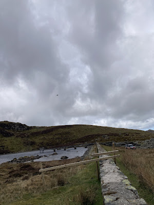
One final section before Llyn Anafon comes into view.
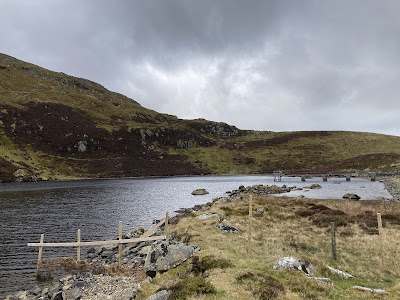
Llyn Anafon.
Llyn Anafon with snowy Drum above.
Llyn Anafon
Llyn Anafon is a reservoir located at an altitude of about 500m. A dam was built across the lake in 1931 to enable water to be supplied to Abergwyngregyn, Llanfairfechan and the surrounding area. But since 2002 this is no longer the case. The dam is at a point where it would need significant investment to meet modern day dam safety standards. As a result Dŵr Cymru are carrying out work to return the reservoir back to a natural lake.
Once the work is completed, the lake will be returned to its natural state before it was made into a reservoir in the 1930s. The scheme has been evaluated independently, and it will continue to support habitats and species of ecological importance and remain a key, ecological and cultural feature in the area. Permission has been granted by Natural Resources Wales (NRW), and work has started to restore Llyn Anafon to its former state, putting it back to its natural water level, which is 1.4 m lower than it is now.
The tower now acts as an overflow for the reservoir and has a series of stock plugs, which will allow the water level to be gradually lowered to the natural lake level (approximately 30 cm at a time). This work will be done over a period of 5 to 10 years, so that the local wildlife and the aquatic plants can be preserved.
Following discussions with the local community, the National Trust has given permission to erect temporary fencing around half the reservoir. This is the to prevent livestock, the Carneddau ponies and the general public from accessing the land that will be open to the elements once the water levels recede. The temporary fencing was installed in late spring 2022 and will be removed once the area has dried. It will be erected again prior to the next drawdowns. After the water in the lake has reached the required level, part of the dam will be lowered to the original stream bed height and a new weir created to allow water from the lake to flow to the stream.
This work has been authorised by NRW who also play a role in monitoring any impacts. Six monthly meetings are held with NRW to review the Water Quality data samples collected monthly. Dŵr Cymru also report back on the macrophyte plants and take monthly fixed-point photographs to show how the shallow water macrophyte is adapting to the reduced levels. Ecological mitigation plans are in place should they be needed and a small population of the rare plants in the lake have also been translocated to the National Botanical Gardens in Carmarthenshire, where they are thriving. As compensatory measures for bringing down the water levels, some of the rare aquatic plants will be moved to Llyn Bran.
There will still be a lake at Anafon after the work is completed, and 60% of the surface area will remain. It is a process of re-naturalising the area to how it looked before being made into a reservoir. Also, by connecting the lake with the downstream water course, other trout populations will be able to reach the lake and increase the genetic diversity. Further improvements will also be made to the track leading to the lake.
We decided to sit and have our picnic at the lake. The Mountain Rescue had parked up nearby and the 5 rescuers had split up and were heading in different directions up from the lake. It was incredible watching the progress they made up the slopes, and also made us feel very small and insignificant watching them disappear into the vast landscape. It really brought home the enormity of their task. The wind was bitterly cold even down in the valley and our thoughts and conversation returned often to the poor lady and her dog who was out there somewhere.
Enjoying Naini’s homemade cake.
Helicopter up above.
She’d just had a telling off from Naini!
Because of how cold it was, we decided not to stay around the lake too long, so we headed back the same way we had come - I mean it’s really the only way unless you want to go actual mountain climbing! Once moving, the cold didn’t seem so bad.
Heading home.
Carneddau ponies.
Carneddau Ponies
The Carneddau Mountain range in Parc Cenedlaethol Eryri (Snowdonia National Park) is home to a small population of around 300 semi-feral Carneddau ponies whose history is said to date back to the Bronze Age. Although they are not designated as a rare breed, they are genetically distinct from the Welsh Mountain Pony and carry genes specifically related to hardiness and waterproofing. They are slightly smaller than the Sec A Welsh Mountain Pony standing at around 10 to 11 hands high, with a sturdy body, small ears shaped like sage leaves, and big personalities!
The Carneddau herd ranges over nearly 13,500 acres or 20 square miles of common between Bethesda, Llanfairfechan, Capel Curig and Conwy, which includes mountains over 3,000 feet high, bogs, cliffs, rocky slopes and lakes. The scenery is spectacular and the ponies know every inch of it. They are owned and managed by the Carneddau Pony Society- a group of local farmers who are supported through a management agreement with Natural Resources Wales that helps them to maintain the herd, grazing to benefit wildlife on the mountains, from Chough to Dung beetles. The ponies graze differently from sheep and have a wider diet than domestic ponies. Their grazing and trampling help to keep bracken and gorse under control, create pathways and maintain the landscape of the mountains.
Under the agreement the herd numbers must be kept steady to avoid overgrazing so draft mares, colt foals and surplus fillies are sold off each year. In the past they were sold as pit ponies but current economics mean they have little value so the graziers need to find new buyers. This is where Pori, Natur a Threftadaeth (PONT), Wales’ grazing organisation, comes in. They work with numerous organisations and have found jobs and homes for 200 of these ponies across Wales and England over the last 10 years. They are great for helping to manage a range of habitats, from fens to dunes to heathlands and grasslands. Sometimes the ponies are handled lightly in a round pen to train them to be head collared and loaded into trailers but they aren’t tamed like a domestic pony as they need to behave naturally and not interact with walkers.
There is an annual gather in November which takes places over three weekends and involves all the farmers and their families, local pony enthusiast volunteers, quad bikes, Landrovers and lots of walking! Once they are down on their farms the surplus animals are sorted for sale. The rest of the herd has a health check, a tail trim to show they’ve been gathered and is returned to the mountains.
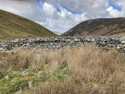
A closer look at one of the sheep folds.
Back past the beautiful sheepfold.
Ynys Môn in the distance.
The homestead down on our left, with the car park at the bottom.
Turn left to cut across down past the old homestead.
R.I.P. Ausra Plungiene. I didn’t know you, but you will always be in my thoughts when I take steps into the mountains that we both loved.
Sources












Comments
Post a Comment