Llanfairfechan - Meini Hirion Standing Stones (5.41km)
A beautiful, easy walk in the Carneddau today with Anwen in the rucksack and 4 year old Megan walking. This route is great if you want to go up into the hills but don’t want to do anything too challenging. It’s also great as it’s off the beaten track so no fighting over parking spaces and you pass just enough people walking, running and cycling to feel safe! (No queuing up any peaks!) There are also the Carneddau ponies to spot, with foals at foot this time of year. Finally, as with all my walks, there’s a bit of history in the numerous cairns, standing stones, and a World War Two plane crash site.
Distance: 5.41km (according to the OS map app)
Time taken: 1hr 30
Total ascent: 227.84m (OS Map app)
Parking: Yes, for a few cars (5 or 6 if parked sensibly)
Facilities: No, but there are plenty of cafes, a Co op and toilets in Llanfairfechan.
1. The main challenge with this route is finding the parking area! It’s right up at the top above Llanfairfechan and there are some narrow, steep and winding roads to get there. The joy of this though is that you’ve already climbed a significant distance before starting your walk so you can enjoy the feel of being in the mountains without all the hard work!
If you want the challenge (and don’t have children to cajole up the hills) there is a big car park on the front in Llanfairfechan, but we are happy to cheat!
To find the parking area, turn up the hill at the crossroads in the middle of Llanfairfechan. Pass the Co-op on your right (handy to grab a picnic). Turn left up Mount Road and follow it to the top. You’ll see two left turns close to each other, the first signed for Plas Heulog. Take the second and go as far as a farm gate. You’ll see a locked gate on the left which leads up to the old Penmaenmawr Quarry. Park in this area, taking care not to block the driveway as it is a working farm.
To start your walk, set off up the farm drive. (Remember to leave all gates as you find them). You’ll pass through the farm yard and then follow a very obvious track up onto the hillside. It’s all uphill at this point but with a few stops to “take pictures” even I managed it! Megan didn’t bat an eyelid. There are about three gates to pass through in total. The views down to the right looking over the village of Llanfairfechan are stunning even at this early point.
Heading up the farm drive.
An interesting water feature!
Gateway to the hills.

Looking down towards Llanfairfechan with Ynys Môn in the distance.
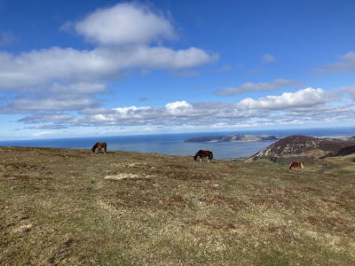
Once through the third gate you come out onto the open hillside with the path very obvious in front of you. On your right you can see an old sheepfold. Once you get to this point, you’ve done the worst of the climbing. You’ll soon start to notice the Carneddau ponies dotted across the hillside.
(You’ll see on my map that I’ve come off the track a couple of times along this section. The first was to take a picture of a pony and the second was on my hunt for the WW2 crash site, which was nowhere near despite a marker post saying otherwise! You can ignore these.)
Carneddau Ponies
The Carneddau Mountain range in Parc Cenedlaethol Eryri (Snowdonia National Park) is home to a small population of around 300 semi-feral Carneddau ponies whose history is said to date back to the Bronze Age. Although they are not designated as a rare breed, they are genetically distinct from the Welsh Mountain Pony and carry genes specifically related to hardiness and waterproofing. They are slightly smaller than the Sec A Welsh Mountain Pony standing at around 10 to 11 hands high, with a sturdy body, small ears shaped like sage leaves, and big personalities!
The Carneddau herd ranges over nearly 13,500 acres or 20 square miles of common between Bethesda, Llanfairfechan, Capel Curig and Conwy, which includes mountains over 3,000 feet high, bogs, cliffs, rocky slopes and lakes. The scenery is spectacular and the ponies know every inch of it. They are owned and managed by the Carneddau Pony Society- a group of local farmers who are supported through a management agreement with Natural Resources Wales that helps them to maintain the herd, grazing to benefit wildlife on the mountains, from Chough to Dung beetles. The ponies graze differently from sheep and have a wider diet than domestic ponies. Their grazing and trampling help to keep bracken and gorse under control, create pathways and maintain the landscape of the mountains.
Under the agreement the herd numbers must be kept steady to avoid overgrazing so draft mares, colt foals and surplus fillies are sold off each year. In the past they were sold as pit ponies but current economics mean they have little value so the graziers need to find new buyers. This is where Pori, Natur a Threftadaeth (PONT), Wales’ grazing organisation, comes in. They work with numerous organisations and have found jobs and homes for 200 of these ponies across Wales and England over the last 10 years. They are great for helping to manage a range of habitats, from fens to dunes to heathlands and grasslands. Sometimes the ponies are handled lightly in a round pen to train them to be head collared and loaded into trailers but they aren’t tamed like a domestic pony as they need to behave naturally and not interact with walkers.
There is an annual gather in November which takes places over three weekends and involves all the farmers and their families, local pony enthusiast volunteers, quad bikes, Landrovers and lots of walking! Once they are down on their farms the surplus animals are sorted for sale. The rest of the herd has a health check, a tail trim to show they’ve been gathered and is returned to the mountains.
Out on the open hillside. You can see the old sheepfold in the distance.
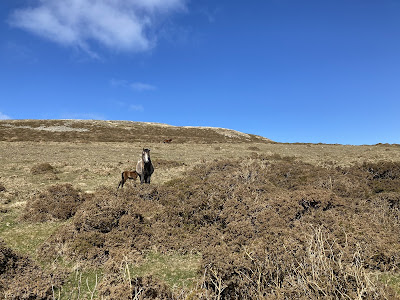
First glimpse of a pony and young foal at foot.
Looking back towards Llanfairfechan along the nice wide track.
Megan resting on a rock.
Beautiful scenery all around.
2. At this point we pass a large Cairn on our left (one of the four Graig Lwyd Cairns) and the track splits. We take the right, smaller path and move up and away from the wall on our left. (If you stay by the wall you’ll come across the remains of the first of four local stone circles in the area- Cors Y Carneddau. There isn’t much remaining and we didn’t head that way today.) The views open up on our left and we can look out across the coast of Gogledd Cymru. Penmaenmawr is directly below us and Llandudno and the Orme beyond. We skirt Moelfre on our right and head up the small hill in front of us.
Looking down at the Orme.
Our path up the hill.
Penmaenmawr directly below with the Orme in the distance. You can’t see it in the picture but the Isle of Man was really clear today.
Looking back the way we’ve come. Our path is the small one at the left of the picture. Graig Lwyd is the ridge on the right of the photo.
As we look back on ourselves here it’s worth pointing out the ridge, Graig Lwyd, known as the Axe Factory.
Graig Lwyd Axe Factory
Graig Lwyd is one of the largest Neolithic axe factories known in Wales. It sits on the extinct volcano above Penmaenmawr. Here, surface outcrops of igneous rock we’re exploited and not only dominated the local market, but reached as far as the Peak District, Yorkshire and the Midlands. Blocks of material were selected from the natural scree and crags and firstly roughly flaked into manageable form before being worked to roughly the correct shape and size. At this point the ‘roughouts’, as they are termed, appear to have been moved from the site and were ground and polished to their finished form elsewhere.
Excavations we’re carried out here in 1919-21 and in addition to the large quantity of flakes and roughouts noted across the hillside, five working floors were discovered.
3. At the top of the hill we come across our first collection of stones (Monument 280 - catchy name). This is a bit of an enigma apparently but is considered to be the remains of a ring cairn. It isn’t very big, but interesting nonetheless.
First glimpse of Monument 280.
Monument 280 with Child 1 having a sit.
Carry on a little further and we get to the impressive stone circle, Meini Hirion (known as Druid’s Circle). You can see Meini Hirion from Monument 280.
Meini Hirion with child for scale.
Meini Hirion.
Thirty stones make up this unevenly spaced circle, with a diameter of roughly 80 feet. The stones are elevated on a rough bank of rubble, and entrance is through a group of 4 stones set 8 feet apart. This circle is known in English as Druids Circle, but despite the name, this stone circle has no connection whatsoever with the druids. In fact, it predates the druids by some 2,000 years. The circle probably dates to the Neolithic period and may be as much as 5,000 years old.
The most striking stone has a very obvious ledge, and this has led to it being called the Stone of Sacrifice, though there is no evidence that any form of sacrifice ever took place here. Curiously, for a stone with such a name, there is a local tradition that if a newborn baby is laid on the ledge, it will have luck for life! (Sorry Anwen, I missed a trick there.) Another legend connected to the circle says that a broken stone was rolled down the nearby hill, causing it to shatter, but in the morning it was restored to its place in the circle.
Excavations in 1957 found evidence of cremation remains. In the centre of the circle was a burial cist with the cremated remains of a child inside an urn. Nearby was a pit containing another urn, also with the cremated remains of a child.
Several prehistoric trackways run past the circle, which suggests that it was a place of some importance.
Meini Hirion.
If you continue on from this point there are two other small stone circles to be found nearby. It’s worth looking at The Megalith Portal (https://www.megalithic.co.uk/article.php?sid=350) to get an idea of just how many historical sites there are in this area.
We were on a deadline today so we turned back at this point.
Heading back towards Monument 280 with Moelfre in the background.
Instead of heading straight back the way we had come we decided to head up a very obvious path to the top of the small hill in front of us, Moelfre, so we veered left when we got to Monument 280.
Looking towards the mountains with Moelfre rising up on the right of the picture.
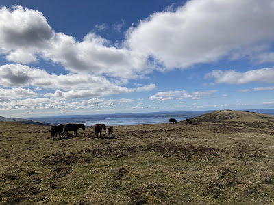
Ponies at the top of Moelfre.
It really wasn’t a difficult climb to the top and the views all around were worth it. Plus, there was a small group of Carneddau ponies grazing up here with a beautiful young foal. Once at the top though we realised that the other side was a tad steeper than what we had just climbed. We could see the path we wanted at the bottom of the hill though. We turned to the left and came down the least steep section, passing another cairn just before we started our descent. We picked our way down carefully amongst the gorse bushes, although it really wasn’t too difficult to be honest.
Spotting something interesting on our way down.
Towards the bottom of the hill we made sure to curve around to the right so that we could join onto the path that would take us back up to join the track home. As we looked up we spotted something interesting ahead of us.
4. We had finally found the crash site and memorial for the American plane, Bachelor’s Baby.
American Plane Crash Site
Five American airmen and their mascot, a terrier called Booster, were killed when their B-24 Liberator Bomber crashed here on 7th January 1944. The picture of the crew (below) was taken by the pilot, Adrian J. Shultz.
The aircraft, named Bachelor’s Baby by its crew, had left their base in Palm Beach, Florida, a month earlier and flown, via Brazil and Morocco, to RAF Fali on Ynys Môn. The plane left Fali with orders to follow a B17 ‘Flying Fortress’ which was to act as the crew’s escort to their new base, RAF Watton, in Norfolk. In heavy cloud and drizzle they lost sight of the B17, and their magnetic compass malfunctioned. They realised they were too low when the clouds broke momentarily. Despite the pilot’s best efforts, the plane struck the ridge, crashed and burst into flames. It was carrying a huge cargo of ammunition which exploded on impact. The surviving airmen struggled to free their comrades.
The bomb aimer, Second Lieut Norman Boyer, made his way down to a farmhouse near Rowen and raised the alarm. Meanwhile, local quarrymen and PC Hughes-Parry of Llanfairfechan hurried to the crash site after seeing and hearing the plane in difficulty. Help also arrived from RAF Llandwrog, base of the RAF’s first mountain rescue service. The helpers administered first aid, then carried the injured down the hillside to Graiglwyd Hall, Penmaenmawr.
Before the survivors were transferred to hospital in Bangor, gunner Sgt Harold Alexander asked quarryman Ellis Lewis to return to the crash site and bury Booster, the mascot. Mr Lewis buried the little black and white fox terrier next to the burnt-out aircraft.
Navigator Second Lieut Julian Ertz survived the crash, but with a broken back. Before the war he played American Football for his high school and later Temple University, Pennsylvania. He was known to fellow airmen as the “singing fullback”. After treatment in Bangor and American military hospitals, he returned to America and recovered enough to finish his law studies. He became an attorney and died on 19th November 2016.
In 1980 a stone memorial was dedicated to the crew and Booster. It stands in a patch of bare rock, where vegetation has still not covered the scar caused by the crash and fire.
Memorial stone.
Crash site.
The next section back up to the main track was a bit boggy in places but perfectly manageable. Once back on the main track we just retraced our footsteps back to the car.
Retracing our steps.
Burning gorse on the far hillside, looking across the sheepfold.
Sources


Diddorol iawn. Ar fy rhestr cerdded rŵan. Diolch.
ReplyDelete